Archives
Enter a word or phrase to perform a general search across all records in the Archives catalog. You can also browse records in the catalog without performing a search.
Search Tips
- Searches are not case sensitive.
- Searching for multiple words connects them with OR by default. Matching records can contain any of the words.
- Connect multiple words with AND if you only want to see records containing both words.
- Use quotation marks to search for a phrase.
- Place an asterisk (*) at the end of a word as a wildcard.
392 results found. Records searched: 392
-
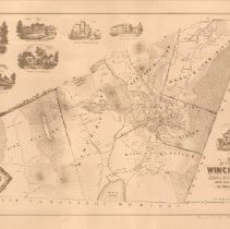
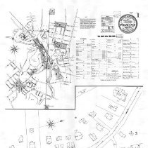
1300.01 - Map of the Town of Winchester, Middlesex County, Mass. 1854
Maps and Plans
Record Type: Archive
-
-
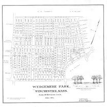
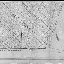
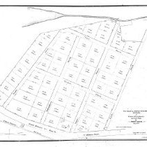
1300.03 - Plan of building lots in Winchester and Woburn belonging to S. S. Holton and L. Holton. Dec. 1874. Surveyed by Josiah Harvey. Dec. 1874.
Maps and Plans
Record Type: Archive
-
1300.04 - The Caleb & Joshua Richardson Estate in Woburn, Massachusetts Survey & Plan by David Gould. May 1847
Maps and Plans
Record Type: Archive
-
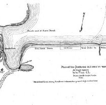
1300.05 - Plan of the South end [Horn Pond] as it was in 1837, at high water. M.M. Tidd, Civil Engineer.
Maps and Plans
Record Type: Archive
-
-
-
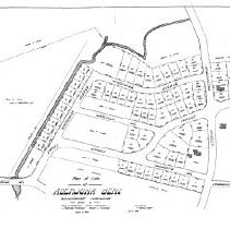
1300.08 - Plan of lots at Aberjona Bend, Winchester Highlands, owned by Moses P. Richardson, Mathilda Richardson, James H. Richardson, Roswell C. Richardson.
Maps and Plans
Record Type: Archive
-
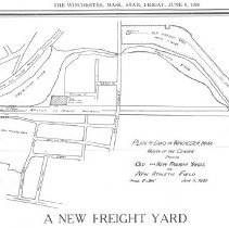
1300.09 - Plan of land in Winchester, Massachusetts north of the Center showing old and new freight yards and new athletic field, June 5, 1939.
Maps and Plans
Record Type: Archive
-
-
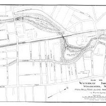
1300.100 - Plan of Waterways improvement Winchester, Mass. About Wedge Pond & Horn Pond Book
Maps and Plans
Record Type: Archive
-
-

-
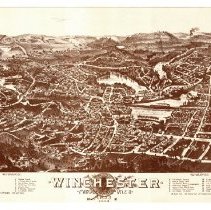
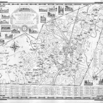
1300.103 - Being a Map of the Town of Winchester in the State of Massachusetts, USA as it is in the year Nineteen Hundred and Twenty Nine; drawn by Ernest Dudley Chase and issued by the Winchester National Bank.
Maps and Plans
Record Type: Archive
-
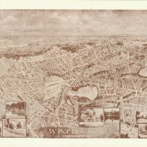
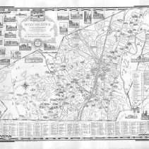
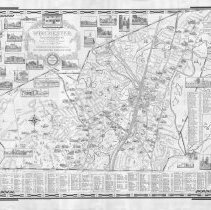
1300.104 - The Town of Winchester, Massachusetts Drawn in 1941 and Brought up to date in 1952 by Ernest Dudley Chase. Distributed with the compliments of The Winchester National Bank.
Maps and Plans
Record Type: Archive
-
1300.105 - The Town of Winchester, Massachusetts drawn in 1941 and brought up to date in 1957 by Ernest Dudley Chase. Distributed with the compliments of the Winchester National Bank.
Maps and Plans
Record Type: Archive
-
1300.106 - The Town of Winchester, Massachusetts drawn in 1941 and brought up to date in 1964 by Ernest Dudley Chase.
Maps and Plans
Record Type: Archive
-
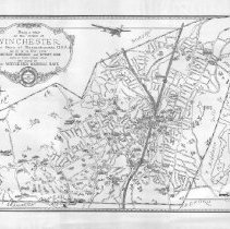
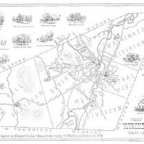
1300.107 - Map of Winchester, Mass. 1854. This map adapted by Ernest Dudley Chase form one by H.E. Walling, published in 1854.
Maps and Plans
Record Type: Archive
-
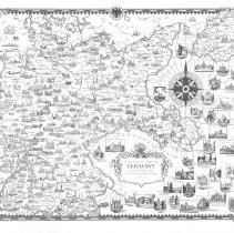
1300.108 - A Pictorial Map of Germany by Ernest Dudley Chase of Winchester in Massachusetts, U.S.A.
Maps and Plans
Record Type: Archive
-
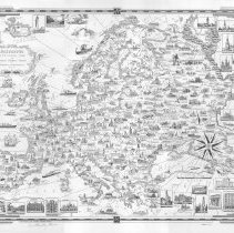
1300.109 - Europe, a pictorial map by Ernest Dudley Chase of Winchester, Massachusetts, U.S.A.
Maps and Plans
Record Type: Archive